Steve’s cousin Tommy (they’re both 65) and wife Elisabeth (we’re both 57), were our earliest inspiration to travel, and the first time we had ever heard of house sitting. Our second and most recent inspiration for house sitting was ~2005 when Teri Hebert introduced us to Janetta and Eddie from South Africa. They were house sitting for friends of Teri’s in Eagleville, CT. [We look forward to visiting them where they’ve settled in New Zealand] Thank you all for sharing your experiences and encouraging us! Tommy had just returned from trekking five of the seven “Stans” in central Asia, which followed the legendary Silk Road, and plans to hike to the Everest base camp this Oct. Go Tommy! But I digress…
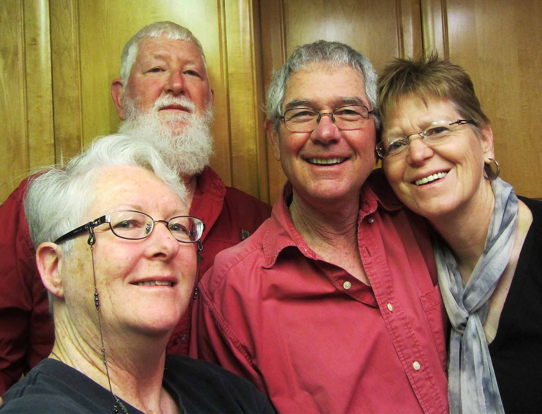
Tommy & Elisabeth.
Though our first time in Sacramento was a whirlwind tour, we got to know Tommy and Elisabeth much better and had such a good time! It was very beautiful there and seems like a great place to live. We had arrived late, yet still had time to catch a gorgeous sunset on a walk in their nearby park. The next morning Tommy led us on a bicycle ride to Old Sacramento, which still looks like an old west town, and we stopped for lunch at Fat City Bar & Cafe. The ride was pretty flat and easy even for me.
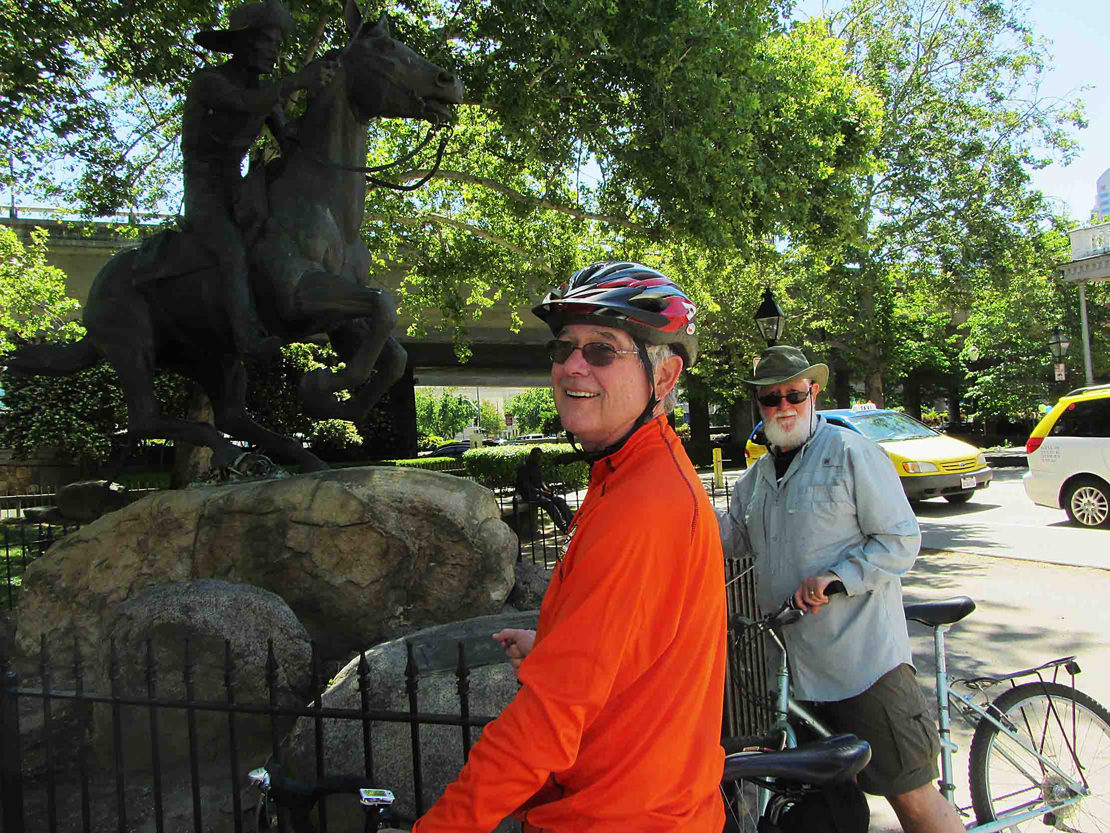
A statue commemorating the historic Pony Express. The end of the trail was in Sacramento.
After a restful afternoon, Tommy prepared a delicious stir fry supper then left for a meeting, so we spent a relaxing evening with Elisabeth. Early the next morning we accompanied Tommy to his Chi Gong exercise in the park, which is similar to Ti Chi. Boy, our muscles really felt that for the next couple of days! We are counting on you guys to visit us in Ecuador.

This is a view from the infamous pass that stopped the Donner Party from crossing to CA. At the far end of Donner Lake is where they endured their hardships.
All too soon we were packed up and driving on Rt 50E to South Lake Tahoe. Turning north on Rt 89 there was a lot of on-going road drainage repairs, which made for very slow progress. We passed Emerald Bay, took in the view at Inspiration Point (where we fed almonds and cashews to the noisy Steller’s Jays), then stopped for a snack at the Bridgetender Tavern in Tahoe City where, due to drought and an unusually mild winter, the river is now little more than a creek.

Steller Jays. Striking!
We drove up to Donner Summit where the overlook of Donner Lake and the valley below was breathtaking. Traversing those mountains with wagons full of furniture (taking them apart time and again and lifting them up and down boulders with block and tackle), livestock and families is beyond imagining, though the Emigrant Trail Museum and Visitor Center have a terrific video about it. At dusk we set up camp at Donner Memorial State Park, the first place we were able to have a fire and it felt great.

Campsite at Donner State Park
We continued on Rt 89N to Lassen Volcanic National Park. Most of the roads were still closed and from the southwest entrance we could only go a mile and see a few boiling mud pots. The ski lifts were closed but there was still plenty of snow on Mt Lassen and the adventurous were snowboarding. We heard about a lava tube you could enter north of the park and, by evening, when we hadn’t found any sign of it, we turned around to grab a campsite and then saw the sign right across the street for “Geological Area and Subway Cave.” Perfect! By now it was cold enough at night to wear a cap on your head and add a sweatshirt over your PJs. In the morning, we strolled along the fast moving creek that ran past the campground and then investigated the lava tube. It was short but interesting, with several informational signs posted inside. From the top we still had a good view of snow-topped Mt Lassen.
To reach Lava Beds National Monument we followed a shortcut the Rangers showed us on a map. Due to winter road closures we had to veer either east or west from Lassen before going north again. Their shortcut took us west on Rt 44, then north over many miles of hard packed dirt road past ranches, hills and meadows until, not far from Shasta Lake, we turned east on Rt 299. Even from a distance snow covered Mt Shasta looked huge.

The only biscuit for William Briggs. Tested and approved.

Entrance into one of the lava tubes.

Mt. Shasta
We stopped for lunch at the grocery store deli in the tiny town of Bieber. Surprisingly, the town also had a Tourist Information Center; they were thrilled to have the rare visitors so we chatted a while. They told us about the Ash Creek Wildlife Area a few miles down the road and Glass Mountain, which both seemed like a good side trip to us.

The deli and central gathering point in Bieber.
The southern end of the wildlife area took us eastward along miles of good gravel road. Marshes and grassland were abundant with geese, wading birds, antelope, thousands of prairie dogs and circling birds of prey, including one bald eagle. Toward the end we were amongst farms. Sadly, we witnessed a farmer in the back of his pick-up truck with a scoped rifle shooting prairie dogs. They weren’t only in the plains but also in the farmer’s fields, most likely damaging what looked to us like forage crops. Steve could see that the farmer wasn’t using a second bullet if the first one only wounded an animal. In Adin we took the paved road that turned west and ran along the northern length of the wildlife area. There were far fewer critters on this side because it was all farmland and no marshes. For two or three days we had been seeing many logging trucks and now we were in the midst of the naked and trashed hillsides left by the loggers.
We took Rt 91N to Rt 139N to Rt 97W to make our attempt at Glass Mountain (made of obsidian). A large fallen tree stopped us about three miles short of the top, and the conditions were not suitable for walking around to look for obsidian rocks. So we backtracked to Rt 10W and Lava Beds National Monument and set up our campsite. Though there were several other campers and RVers, like every other place we had camped thus far, the campground was very quiet because the campers were adults, not families. Along the way, many campgrounds were still closed and, we were told, some mountain/scenic routes don’t open until mid-July. Valentine cave is the first one you pass when entering Lava Beds and, of course, we wanted to go in right away. However, signs indicate that you must first go to the visitor center to be screened for white-nose syndrome, a disease killing bats that has spread as far west as parts of Oklahoma. Once you have assured them that you aren’t wearing any of the same clothes or using any of the same equipment that you used in caves in any infected areas within the last three years, they give you a pass to put on your dashboard. Most of the cave entrances are far enough apart to drive to, and they are categorized in to three levels of difficulty. During the summer, some caves are closed to visitors to protect maternal bat colonies where thousands of bat pups are raised on the ceiling. Other caves that contain hibernating bats are off-limits in winter because they can die if awakened too often. This area is home to 14 species of insect-eating bats.
We explored four of the least challenging caves: Mushpot, Valentine, Sentinel, and Skull, and two moderately challenging: Sunshine and, lastly, Golden Dome. Each one was very unique and, because it was so sparkly in some areas (actually the result of light reflecting off water droplets that bead up on coatings of non-harmful hydrophobic bacteria), our favorite by far was Golden Dome.

Hydrophobic bacteria. Think oil and water and the way they are not attracted to each other. The reason we could see this bacteria was because moisture had formed on the ceiling, magnifying the gold color — a strange relationship. Don’t blow it up because it is not in focus. Just enjoy the golden sheen.
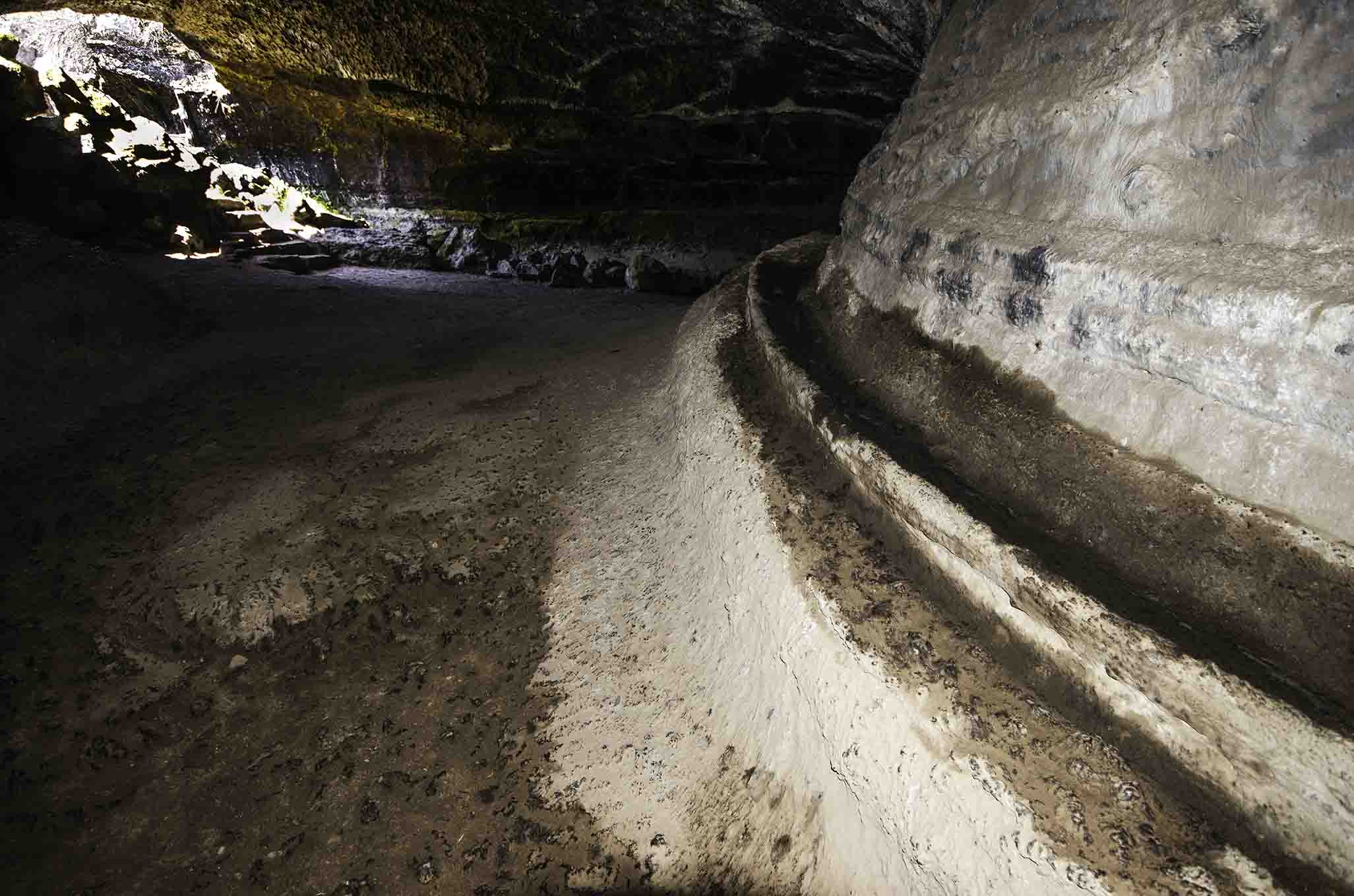
This is a shelf formed when lava was flowing through the tube. At the shelf level the lava slowed long enough to harden on the edges. Then the lava began to flow again, which lowered the tube floor and left behind the shelf. It was on both sides of this tube and ran for quite a distance.
It also had the narrowest entrance, required the most stooping, and had the most sections of any that we entered, so even with the map we did get a little turned around when exiting. That was a little nerve wracking just because I didn’t want to spend hours going in circles. We would like to have done a few more but these took us to 1:30 and we were pretty tired and hungry. Over 450 lava tube caves have been discovered in the region, over 200 within the park having been explored to some extent, with only about 100 of them being described. You are free to roam the desert and discover caves on your own, and we met a man who had been coming here for years to do just that. He regularly checks in at the ranger stations and said it’s his favorite place on earth.

Captain Jack’s stronghold. He and his followers were able to move about freely inside these natural walls and fend off more than 300 soldiers. The military cut off the water supply which ended the siege.
The Modoc Indian War of 1872-1873 occurred in this area (the only Indian war in CA). We walked the trail of Captain Jack’s Stronghold where (his Modoc name was Kintpuash), after having left the Klamath reservation due to hardships and clashes among other tribal bands, then tensions with area settlers on their homeland, Captain Jack’s band of 50 fighting men made their final stand among the caves, gulleys and boulders. He was one of the younger Modoc Chiefs. Here they held off a seige of over 300 soldiers for nearly five months. The lava beds area is desolate high desert and that’s all the Modocs wanted for land, but the U.S. government forced them on to a reservation instead. Back at Fort Klamath, the Chief was hung and most of his followers died of starvation and disease at the reservation.
Turning our minds to happier thoughts, we set the GPS for Klamath Falls, Oregon and on to the next stage of our adventure.

